Jasło
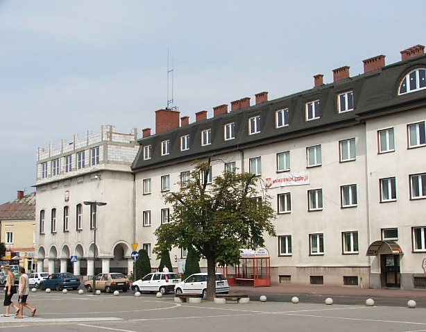
The north side of the square in Jaslo with the district administration building
Distance
Population
37.562 (2006)
Location and history
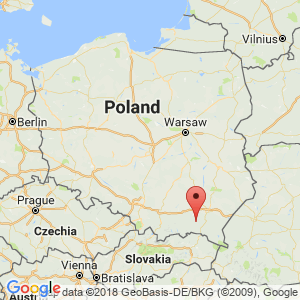
Jasło is located in southeastern Poland, in the western part of the Podkarpacie region. The town is located where the river Wisłoka (an eastern tributary to Wisła) during its south-northward course receives inflows from the rivers Jasiółka and Ropa.
The term Jasiel for a settlement in this place is first encountered in the written sources during the year 1185. The town was granted market town rights in 1365, issued by King Kazimierz Wielki during a stay in Sanok. From being the property of the Cistercian Order in 1368, the city became royal property. Especially in the 16th century. the city developed strongly, thanks to the convenient location of the so-called “Hungarian trade route”. During the Polish division, Jasło was under Austrian rule and belonged to the province of Galicia. During the German occupation in World War II, a strong resistance movement appeared in the city. By the end of the war, Jasło was totally destroyed. In September 1944, as the Russian forces approached the area, all civilians were forced out of the city, after which the Germans robbed all that had any value in the city, and subsequently blasted virtually every building in the air. This devastating action, apparently of no strategic importance, lasted from October to December 1944. In January 1945, Russian forces invaded the ruins of Jasło. After the war, there were plans to relocate the city to another location, but residents decided to undertake a reconstruction.
Tourist attractions
Due to the complete destruction during the war, there are no old buildings in their original form. Everything is either rebuilt, reconstructed or completely rebuilt.
The parish church
The Virgin Mary Church – the parish church – near the northeast corner of the square is originally the oldest church in the city; It dates from the 15th century, probably 1446. The church was rebuilt in Gothic style after the church, with the exception of the tower.
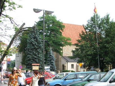
From the northeast corner of the square. Behind the greenery lies the town's parish church
Regional Gallery.
The Jewish Cemetery (Kirkut).
Stadsparken
founded by teacher Teodor Bernardzikiewicz. Here you will find a statue of Tadeusz Kosciuszko from 1879, the Tomb of the Unknown Soldier from 1894 and a gazebo built on the occasion of the visit of Austrian Emperor Franz Joseph in 1900.
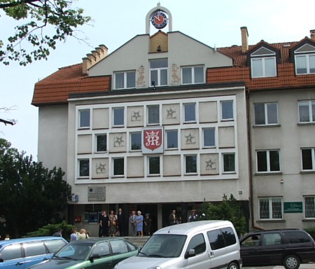
The town hall on the east side of the square
Surrounding Area
Trzcinica (about 3 km west of Jasło)
Here, an open-air museum will be erected, where both the Bronze Age-covered settlement and the medieval settlement at the same site will be presented, including the defensive walls, and the life of the early Middle Ages, local businesses, etc. will be revived.
Accommodation
Booking.com
Jasło The official site of the city – in Polish and English. With practical information for tourists
Eating Out:
Jasło The official site of the city – in Polish and English. With practical information for tourists
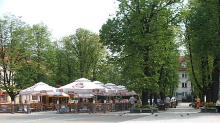
The eastern, partly overgrown, part of the huge square in Jaslo, the city's central square, with a.k.a. serving opportunities
Other Internet sites and sources
Jasło The official site of the city – in Polish and English
Gmina Jasło wita Jasło Land Municipality page
Powiat Jasielski Jasło District page
Translated into English by Google Translate. Spangshus.dk accept no liability for any errors or omissions in translation.
Map
Rating
Search
Most used tags
churches (205) Castles (86) Monasteries (79) Town walls (74) Lakes (71) Town halls (67) Rivers (65) Castles1 (62) Mansions (55) Museums (51) Regional museums (38) Town gates (36) Abbey churches (35) Castle ruins (30) Cathedrals (26) Forests (25) Health resorts (24) Mounds (23) Water sports (23) National parks (22)Click for all tags
Denne side er også tilgængelig på dansk. This page and contents is (c) Copyright 2018- www.spangshus.dk. Based on Inviator software by ISCA Software