Gryfów Śląski
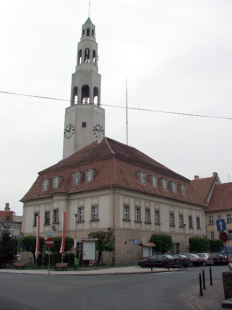
Town Hall on the square in Gryfów Śląski
Distance
Population
10.202 (2008)
Location and history
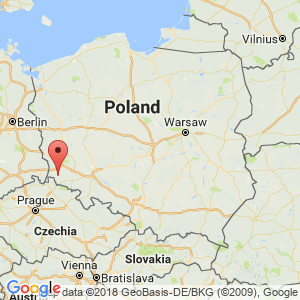
Gryfów Śląski is located in the south-west corner of the Lower Silesia region, not far from the Czech and German borders. The River Kwisa runs through the city; Kwisa, which passes further north to the city of Lubań, is a tributary to Bóbr, which in turn is a tributary to Odra. The nearest major city is the former county capital, Jelenia Góra, 29 km to the southeast.
Gryfów Śląski got under Silesian prince Bolesław Łysy’s (the Bald) government granted the first market town rights in 1242. But in addition, it is uncertain when the city was originally founded. However, it is believed to know with reasonable certainty that in the present city area, a castle existed early, possibly erected by Bolesław Wysoki (the High). The 15th year. was a downturn for the city; Among other things, the Hussitter wars left their mark and the population dropped drastically. The following centuries brought prosperity, owing, inter alia, to the Schaffgotsch family’ and Mayor Hans Rother’s initiative. While Silesia was under Germany, the town was called Greiffenberg. In 1783, an extensive fire ensued, destroying much of the city. In the 19th century. there were rail links to the cities of Jelenia Góra, Lwówek Śląski, Świeradów-Zdrój and Zgorzelec. In 1929, the town hall tower burned down; it was subsequently erected in iron concrete.
Tourist attractions
City Hall
The town hall stands in the middle of the square. Of the original building, there is not much left, especially some vaults and the large mansard roof, as well as some details such as the city coat of arms on the north side of the tower. After the fire in 1929, the tower was rebuilt as a structure in iron concrete, one of the first of this kind of building structures in Lower Silesia.
(See photo at the top of the page).
Church of St. Hedwig (Kościół Św.Jadwigi)
In the church square stands the parish church of St. Hedvig's Church, which is a late Gothic building from the 14th-16th century. Notable in the church are especially the high-altar and the epitaph of the Schaffgotsch family. The Gothic wooden cabinet altar was made in 1606. When the wings are folded, it looks like a monster trance. It is adorned with symbols of Patience, Mercy, Reason, Hope, Justice and Bravery. The Schaffgotsch epitaph is carved in sandstone with portraits of the dead in body size.
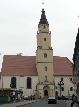
St. Hedvig's Church
Saint Laurent’ Church (Kościół Św.Wawrzyńca)
dates from the 15th century. In the north wall are tombs from the Baroque and Rococo period. The cemetery extends in a northerly direction. On the cemetery wall are epitaphs and tombs for rich citizens of the city.
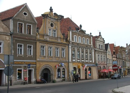
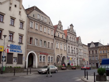
Townhouses by the square
The townhouses of the square are from the Renaissance and Baroque times and are built of bricks, usually with a narrow gable facing the square itself, but in turn with several subjects in the longitudinal direction of the house and the grounds.
Gryfów Śląski. Townhouses on the west side of the square
The fountain in the square
In commemoration of the city's municipal water supply in 1905, a stone column with fountains was erected by artist Arnold Kunne of Berlin.
Bymuren
The city wall was built around the year 1300 on the initiative of Prince Bolko of Świdnica. The remaining lots can be seen at Rzeczna and Parkowa streets.
Surrounding Area
Jezioro Złotnickie
The river Kwisa, which comes from the south, turns at the southern boundary of the old town to the west and forms about 1 km to the southwest a lake: Jezioro Złotnickie. The surrounding area offers opportunities for a relaxing holiday and for beautiful nature experiences in the forests and on the river and lake, where there are rich fishing opportunities and water sports facilities.
Rząsiny (6 km north of Gryfow Slaski)
Here you can see the ruins of the Knights Castle Podskale, which was built on rocky ground on a ridge, probably in the 14th century. In 1479, the castle was captured and destroyed by (among other things) the Hungarian king's army forces.
Proszówka (About 3 km south of Gryfów Slaski)
In the southern part of the village stands the ruins of the castle Gryf, built on the slope of a ridge, 462 m. Probably the castle was erected in the second half of the 12th year. by Prince Bolesław Wysoki, while the further expansion is due to Henryk Brodaty. The castle was an important support point in the country's defense against Czech attacks. The castle area was divided into three sections: the stronghold, the middle castle and the hidden. From the stronghold there is a view of the mountains to the south and southeast: Góry Izerskie and Karkonosze.
Accommodation
Gryfów Śląski. Townhouses on the south side of the square
Other Internet sites and sources
Gryfów Śląski (Town official page)
Translated into English by Google Translate. Spangshus.dk accept no liability for any errors or omissions in translation.
Map
Rating
Search
Most used tags
churches (205) Castles (86) Monasteries (79) Town walls (74) Lakes (71) Town halls (67) Rivers (65) Castles1 (62) Mansions (55) Museums (51) Regional museums (38) Town gates (36) Abbey churches (35) Castle ruins (30) Cathedrals (26) Forests (25) Health resorts (24) Mounds (23) Water sports (23) National parks (22)Click for all tags
Denne side er også tilgængelig på dansk. This page and contents is (c) Copyright 2018- www.spangshus.dk. Based on Inviator software by ISCA Software