Wałcz
Distance
Population
26.231 (2013)
Location and history
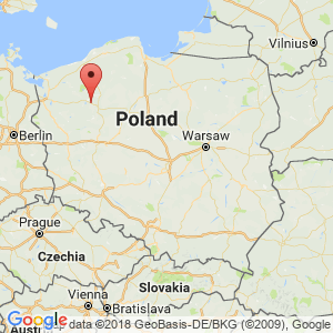
The town of Wałcz is located in northwestern Poland, in western Pomerania, southeast of Szczecin.
At the time when the West Slavic tribes began to form a state formation, the Wałcz area was on the outskirts of the territory where the tribes of Polanie and Pomorzanie ruled. In the first half of the 12th year. the area was incorporated into the Polish state by Prince Bolesław Krzyvousty. At that time, the area was considered the northernmost part of the Wielkopolska region. Around the year 1300, the county of Brandenburg ruled this area. In 1303, the city was granted market town rights, issued by the field excavators of Brandenburg, including rights to 2 lakes with islands and a peninsula as well as 16 years of tax exemption. The Wałcz area again came under Polish rule in 1368 after an agreement between the Polish king, Kazimierz Wielki, and the Count Count Otto V. the King's representative, the Star oost, took a seat on the castle of Wałcz. The city now belonged to Poznań county. After Poland's first division in 1772, Wałcz belonged to the Prussian province called West Prussia. In the 19th century. there was significant business development in Wałcz. There were several sawmills, an iron foundry, machine factory, furniture factory, printing plant, brewery and a lime kiln. In 1881 a railway line came to the town of Piła. By the Treaty of Versailles in 1919 after World War I, Wałcz remained in Germany. Of the city's inhabitants, a significant majority were Germans. At the end of World War II, in February 1945, the city was liberated after the fortification of the Pomeranian Violence had been breached. Most German residents fled to the west as the front approached. After the end of the war and Poland's takeover of the area, the remaining German inhabitants were expelled to Germany. Poles from several parts of the country, especially from eastern Poland, settled in Wałcz. From 1975 to 1998, the city belonged to Piła County, but from 1999 Wałcz was admitted to the West Pomeranian county.
In Walcz, several military units are stationed: battalions within the signal service, logistics troops, military hospital and others. The military area is located in the city itself, north of the city center.
Tourist attractions
Selected attractions:
City Hall
was built in 1890. It is a two-storey building (with basement) in an eclectic style. The town hall is a corner building on the square (Plac Wolności). The building is crowned by a small neobaroc style tower.
Saint Mikołaj’s Church
It is a neo-Gothic building, erected in 1863-1865. A lot of furniture from the former church is preserved, thus 4 bells, a side altar with silver fittings, ornaments with embroidery in gold and silver, made in 1620 and 1717, 6 silver candlesticks from 1733, two small reliquary sf silver and an altar lime with inscription; in addition, several pictures with religious motifs. In 1951 the church was renovated. In 1961 new mosaic tiles were installed.
Church of the Holy Trinity
is the church of the Greek Orthodox Church. The first Orthodox service was held at the church in March 1946. The church was originally an evangelical cemetery chapel dating from the 19th century.
Wałcz-Egnens Museum
The building is a classicist style house from the beginning of the 19th century. The museum is located on the peninsula of Borgsøen. Here are a section dealing with the Fortress of the Pomeranian Violence and the breakthrough of this German line of defense at Wałcz at the end of World War II.
Castle of Wałcz
There is no longer any trace of the castle. With a probable boundary probability, it is believed that the castle has been located on the peninsula that from the northwest and thus from the city center shoots out into Jezioro Zamkowe (Lake Borg), the lake's name is the only one left of the castle. This peninsula was mentioned in the letter of privilege of 1303 under the lands belonging to the city. It is believed that the castle was built by the field excavators of Brandenburg in the late 13th century, when they had conquered the area. The Wałcz area again came under Polish rule in 1368 after an agreement between the Polish king, Kazimierz Wielki, and the Count Count Otto V. the King's representative, the Star oost, took a seat on the castle of Wałcz. The city was destroyed by a fire in 1378, but the castle avoided the flames, which could probably be because it was by the lake. In 1407 the town was occupied by the Crusaders, but the castle did not surrender. A new attempt by the Crusaders to conquer the castle in 1409 also ended unsuccessfully. In 1442, the castle was leased by Jan Wedel-Tuczynski and later by his descendants. In the middle of the 16th century. the castle was ruled by the genera Górków, Grudziński and others. In the 17th century. the castle was destroyed and abandoned, probably as a result of the Swedes' attacks. Star cheese was then Franciszek Wejher. In the 18th century. a remnant of the walls was still visible above the ground. At the beginning of the 19th century. the castle had completely disappeared; there was no trace of it above the ground.
Surrounding Area
rivers:
Żydówka River runs through 4 lakes and last through Lake Raduń, from here through Wałcz (where part of the stretch is channeled), thence further north with an outlet in the Piławka River north of Wałcz.
Piławka is a small river with a total length of 15 km north of Wałcz with outlet in Dobrzyca.
Lakes:
The town of Wałcz is located in the middle of the South Pomeranian lake landscape on Lake Raduń (Jezioro Raduń) and Borgsoe (Jezioro Zamkowe). Both of these lakes go all the way to the city center, partly from the southeast (Borgsøen) and partly from the southwest (Raduń).
Borg Sea is an elongated lake, almost in the northeast-southwest direction. The total length of the widths is almost 11 km. From the northwest, a peninsula protrudes into the Borgsøen, a peninsula on which the now-defunct castle is believed to have been located. On the north side (near highway no. 10) is a smaller marina. It is allowed to sail on the lake by motor boat. The lake has a flow from the south and a smaller drain to the north, which is initially led in a canal under and through the city's settlement and then united with the drain from Lake Raduń. From 2003 fish fry have been put out in the lake.
Radun Lake , a glacier lake from the end of the last ice age, is even more elongated than the Borg Lake. The total length of the widths is over 19 km. The average depth is 9.5 m. At the narrowest point, a suspension bridge (Most Kłosowski) spans the lake. The bridge is intended for pedestrians only. Immediately southeast of the bridge is the city's Central Sports Center and a swimming pool. At the lake shore there is a beach and nearby there are several tent pitches. Parallel to the lakeshore, a red marked tourist trail from Wałcz leads through the forests and southwest to Drawno National Park. The southwest part of the lake, separated from the main lake by a small island, is called Jezioro Dybrzno. There are many fish in the lake, so species, eel, bream, pike, skull, perch, carp, south and moth. In the section of the lake which lies between the bridge and the town of Wałcz, it is allowed to sail by motor boat.
forests:
West, north and east of the city there are large forest areas.
roads:
Two main roads, nos. 10 and 22, pass through the city itself and intersect just northwest of the center, at the roundabout Rondo Solidarności.
Fortifications:
The Pomeranian Violence (Wał Pomorski, German: Pomerania) was part of a series of fortifications designed to protect the Third Reich to the east. The Pomeranian violence was built and expanded in the years 1932-1945. To the south, the plant was connected to the Fortified Międzyrzecz Region and the Odra Line. The German bunkers (thus also those found near Wałcz) had several floors underground (to a depth of 15 m.), 200 cm thick walls and 190 cm thick floor decks. They were all armed with two swivels, 3 machine guns, grenade launchers and a periscope. They each had room for 90-100 soldiers. The fortified line was located immediately to the east and around Wałcz. The fortified line stretched for more than 200 km, making use of natural obstacles in the landscape such as rivers, lakes and swamps. At Wałcz there was a single hole in the fortification line. As the Soviet army approached from the east, the military leadership therefore decided to seek to break through the line of defense at this location. First, Polish Army forces broke the line a few miles north of the city. In order to avoid being completely surrounded by the Soviet army as well as the cooperating Polish army, the German crew chose to evacuate the piles, after which the Soviet army broke the line of defense at Wałcz in February 1945 and liberated the area. including the city of Wałcz. After the war, all elements of iron as well as other useful materials were removed from the piles. Some of them were blown up in the air. But there's still a lot left to look at. Visitors, while accompanied by a guide, can see some of the preserved German bunkers. The section on the breakthrough of the Pomeranian violence in the Wałcz-Eggen Museum can also be seen.
Accommodation
Other Internet sites and sources
Translated into English by Google Translate. Spangshus.dk accept no liability for any errors or omissions in translation.
Map
Rating
Search
Most used tags
churches (205) Castles (86) Monasteries (79) Town walls (74) Lakes (71) Town halls (67) Rivers (65) Castles1 (62) Mansions (55) Museums (51) Regional museums (38) Town gates (36) Abbey churches (35) Castle ruins (30) Cathedrals (26) Forests (25) Health resorts (24) Water sports (23) Mounds (23) National parks (22)Click for all tags
Denne side er også tilgængelig på dansk. This page and contents is (c) Copyright 2018- www.spangshus.dk. Based on Inviator software by ISCA Software